






Wednesday, 18 November 2026 06:00 AM
Company Update
Waldo turns ideas about the physical world into production spatial data analysis
SAN FRANCISCO, CA / ACCESS Newswire / November 18, 2026 / Wherobots, the context engine for physical world data, today announced Waldo, an AI agent that turns ideas about the physical world into production spatial data analysis and pipelines. Data engineers and analysts describe what they want in natural language. Waldo finds the data, builds and runs the analysis, maps the result, and schedules the work to run again as new data arrives.
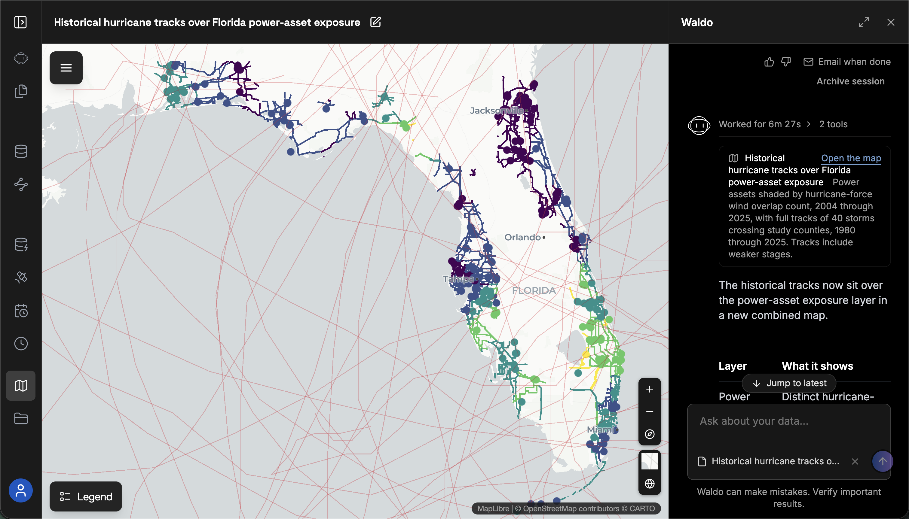
Spatial data is information tied to places on Earth: satellite imagery, building footprints, road networks and GPS traces. Waldo was built by the team that created Apache Sedona and brought spatial support to Apache Spark, Apache Iceberg and Apache Flink. It runs on Wherobots, against open datasets and the private data teams already keep in their lakehouse.
Ending the rationing of spatial data work
The physical world is quickly changing, and insurers, utilities, logistics operators, telecom carriers and agriculture companies rely on data and AI to plan, price risk and run operations. General-purpose AI agents, cloud data platforms and legacy GIS software were not built to process multimodal spatial data at scale. The people who can are scarce: a 2026 industry study found the geospatial workforce is 10 to 15 years behind the skills employers need. Teams pursue the few ideas that justify weeks of specialist work and shelve the rest. Waldo removes that bottleneck.
"Coding agents are automating software development, but development with spatial data has been left behind," said Mo Sarwat, CEO of Wherobots. "Waldo makes spatial data expertise accessible to nearly anyone, so teams can take their ideas about the physical world into production in days rather than weeks."
What Waldo does
Waldo is the spatial data expert most data teams wish they had, available as an AI agent. It picks the right part of Wherobots for each step of the task:
- Finds and prepares the data: Waldo searches Havasu Catalog for open datasets such as Overture Maps and Sentinel-2, alongside the team's private data, and checks each source for coverage and fit before using it.
- Turns imagery into features: Waldo uses RasterFlow to prepare satellite and aerial imagery and run computer vision models on it, producing features such as flood extents, building footprints or land change.
- Runs the analysis at scale: Every query Waldo writes runs on WherobotsDB, with more than 300 vector and raster spatial functions, from a single city to the whole planet.
- Ships to production: Waldo maps the result in Wherobots Maps, writes it to the team's existing catalog, such as AWS Glue or Databricks, and schedules it to refresh as new data arrives. No data migration is required.
A fleet team, for example, can ask Waldo to "process the latest batch of GPS data from our fleet positions dataset, map the trips that ran off route or behind schedule, flag the trips likely affected by weather or traffic, and write the results to our Databricks catalog."
"Fleet observability begins where fleet monitoring ends. Our customers need to know why a fuel reading that looks anomalous on a highway is normal on a mountain pass, and that answer depends on spatial context. With Waldo, our engineers ask that question in plain language, and Waldo builds the analysis across billions of telemetry records and turns it into a pipeline Aspen Fleet runs every day. We now ship new spatial data products and analyses two to three times faster," said Sergey Sukov, CEO at ActionEngine.
Availability
Waldo is available today in public preview, with Waldo tokens included at no additional cost in Wherobots Professional Edition. Teams can sign up with an email and start in minutes at wherobots.com/waldo.
About Wherobots
Wherobots is the context engine for physical world data. Founded in 2022 by the original creators of Apache Sedona, the open-source spatial engine with more than 82 million downloads, Wherobots gives data teams and AI agents a cloud-native platform for spatial analytics, imagery inference and spatial AI on data where it already lives. Organizations including Amazon, Nearmap, Ordnance Survey and Allstate use Apache Sedona and Wherobots to build on physical-world data at planetary scale. Wherobots is headquartered in San Francisco. Learn more at wherobots.com.
Media contact
Michael Lindenberger
Lindy PR
[email protected]
SOURCE: WHEROBOTS